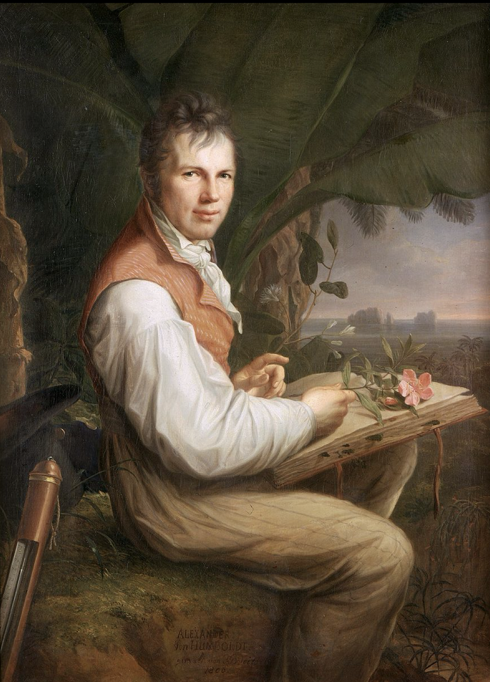
Alexander von Humboldt portrait, 1806, H.G. Weitsch, Alte Nationalgalerie, Berlin (Photo P. Hunt 2016)
By Patrick Hunt –
Introduction
Alexander von Humboldt (1769-1859), the German polymath naturalist and explorer genius whose travels took him to the New World for several years, made many astute observations and discoveries about geography and climate as well as pioneering archaeological study in Mexico, Ecuador and Peru. Whether or not he deserves as much credit as accorded in recent books, for example, by Andrea Wulf in The Invention of Nature: Alexander von Humboldt’s New World (Vintage 2016), or the newer Andreas Daum Alexander von Humboldt: A Concise Biography (Princeton 2024), which accounts seem at times hagiographic, it is hard overall not to admire von Humboldt. He was a singular scholar bridging wide-ranging interests across science and humanities. Even his Latin American detractors (like Cañizares-Esguerra) notwithstanding – who probably rightly accuse him of cavalierly not sufficiently crediting his New World antecedents and Latin American contemporaries or of inaccuracy in some botanical data collecting – cannot escape how much positive influence he had in shaping successive European scholarship, including a profound impact on Charles Darwin, whom he mentored long-distance.
In addition, von Humboldt’s cultural explorations were also notable as he visited Aztec, Maya and Peruvian archaeological sites long before most other Europeans were interested in New World archaeology. He rightly disparaged the negative effects of colonialism and indigenous slavery as well as the ways in which some of the best engineering in New World hydrology and aqueduct creation had been destroyed by invasion and conquest by arrogant fellow Europeans in the 16th through 18th centuries. Unlike his more bookish older brother Wilhelm, Alexander preferred the outdoors and collecting everything he could from nature as a boy. [1] He was one of the first to acknowledge Aztec and Maya architecture – after the chroniclers in the 16th c. Age of Exploration – and facilitated rediscovery of the Dresden Codex (although he first thought it was Aztec, not Maya). Other New World achievements and encomia of indigenous civilizations are recorded in his wide-ranging 1810 Vues des Cordillères et Monuments des Peuples Indigenes de l’Amérique. [2] In the New World, von Humboldt traveled from Cumaná to Caracas (Venezuela) along the Orinoco in the Amazon (1799-1800); from Cartagena (Columbia) then south along the Andes via Quito (Ecuador) and through the coastal desert to Lima (Peru), then back up north to Guayaquil (Ecuador again). Finally, he traveled north onward to Mexico (1801-1803) from jungle to desert. In five years von Humboldt covered 6,000 miles collecting data and botanical flora. Darwin later described Humboldt “as the greatest scientific traveler who ever lived.” [3] Thus, while von Humboldt’s non-European detractors often remain unimpressed, I find Humboldt’s life and contributions to physical geography foundational and prescient for what followed his era. I am also particularly empathetic to his statements about Mesoamerican and Peruvian technology and some of the deleterious effects of Colonialism:
“…The largest and finest construction of the Indians in this way is the aqueduct of the city of Texcoco…How must we admire the industry and activity displayed in general by the ancient Mexicans…” [4]
Also regarding the coastal Peruvian cultures with their vast hydrology system of aqueducts extending from the Andes to the arid coast, with mostly far larger agricultural use in antiquity than he saw around 1800 or even after him to the 20th century, Humboldt sadly noted:
“…The conquistadors of the sixteenth century destroyed these aqueducts…the region has become a desert destitute of vegetation…Such is the civilization carried by the Europeans among the people whom they are pleased to call barbarians…” [5]
Altitude-Latitude Correlations
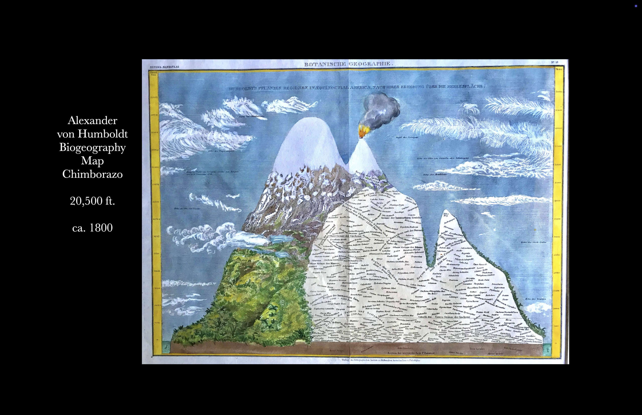
But it is mostly von Humboldt’s biogeographic understanding of how latitude and altitude correlate that is the main focus here, extrapolated from his 1803 Naturgemälde and his “Atlas of Geography.” Essentially in his surveys of botany and geology on stratovolcanoes like Mt. Tiede in Tenerife (~3718 m, 12,200 ft.) in the Atlantic, and in the Ecuadorean Andes, starting with Mt. Pichincha (~4784 m, 15,696 ft.) and especially Mt. Chimborazo (~6263 m, 20548 ft.) in 1802, von Humboldt recognized that the higher one climbed in altitude even when starting from a tropical sea level, the climate changed to resemble arctic or antarctic latitudes at the highest altitude if above ~3000 m (~10,000 ft). Augmenting his surveys with at least 50 scientific instruments including barometers, thermometers, sextants, telescopes and other measuring devices, he published much of his seminal science observations in his 1805 Géographie des Plants Équinoxiales.
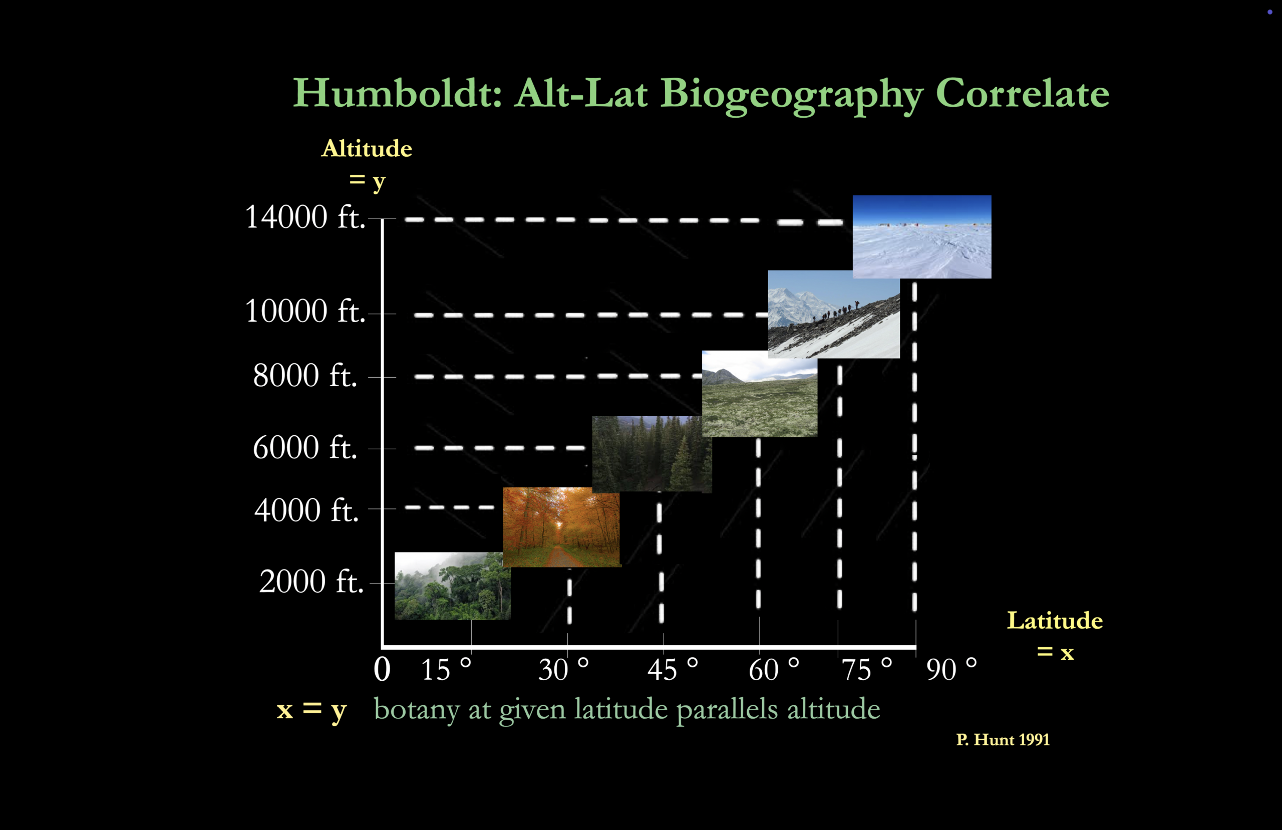
Important here, especially for both climatology and archaeology, are his relative correlations of altitude and latitude that I have roughly graphed below here in a relative Cartesian coordinate schematic of basic vegetation zones: the horizontal x axis represents latitude from left to right (from 0° to 90°), and the vertical y axis represents altitude from low to high (around ~2000 ft to ~14,000 ft.), which other studies including my own field research observations and photos corroborate.
Essentially, although I have relativized and amalgamated Humboldt’s data with my own, another of his basic premises is observable in the following axiom: nearest the equator, the forested vegetation tree line is highest; in contrast nearest the poles the forested vegetation tree line is lowest. The visualized intersection of the dotted lines between x-y axes can only be relative because there are so many different habitats and incongruent variables like proximity to coast and winds, but the basic idea is valid.
Specific Latitude Tree Lines
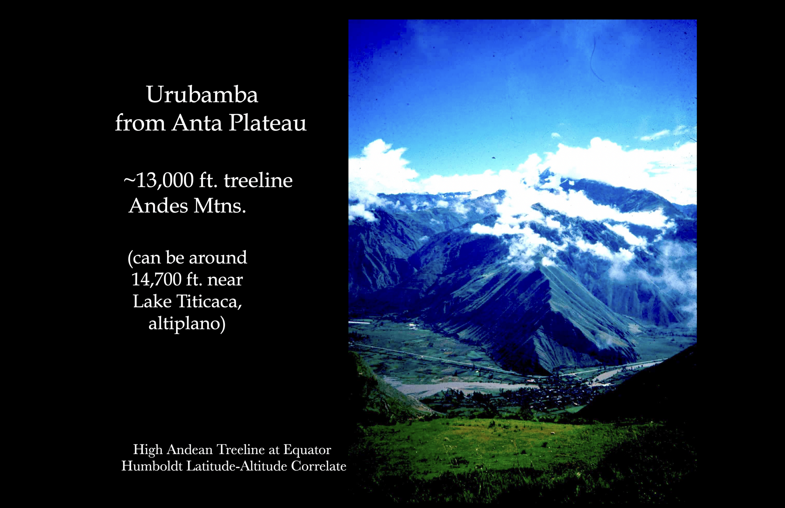
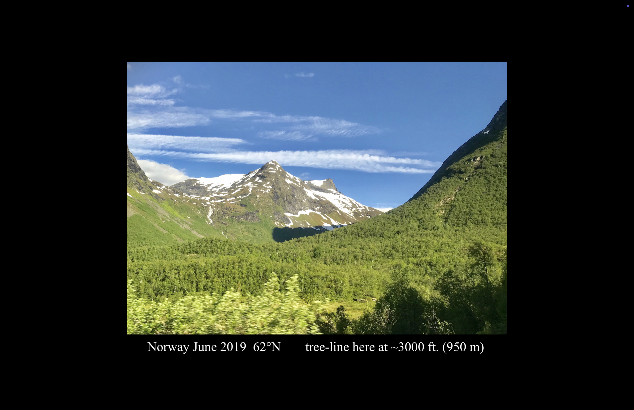
The details below are from my own fieldwork. For example, in the Andes above the Yucay Valley (Urubamba River watershed) along the Anta Plateau at ~3400-4000 m ( ~11,200-13,000 ft.) elevation, with its latitude around 13°S, one easily finds eucalyptus groves and other modest forest habitats in the Andean slopes sometimes even up to a maximum tree line around ~4250 m (14,000 ft.) on the Altiplano. In the Sierra Madre Occidental of Mexico at roughly 22-28°N, one easily finds coniferous forest up to ~3600 m (~12,000 ft.); in the Sierra Nevada of California at 37°N , one finds the coniferous tree line around ~3000 meters or ~10,000 ft. Then in the European Alps around 45°N, the coniferous forest tree line is between ~1800-2100 m (~6500-7000 ft.) elevation, and in interior Norway at around 62°N the coniferous tree line is around ~950 m (~3000 ft.) elevation, whereas close to the coast above Anchorage, Alaska, the tree line at 61 °N is right above the city around ~450 m (~1500 ft.) elevation. In some of these latter contexts, the cool to cold ocean breezes and/or strong winds can also contribute to vegetation density or lack thereof. So as a pioneering geographer Humboldt was absolutely correct to observe and publish this correlation of altitude and latitude.
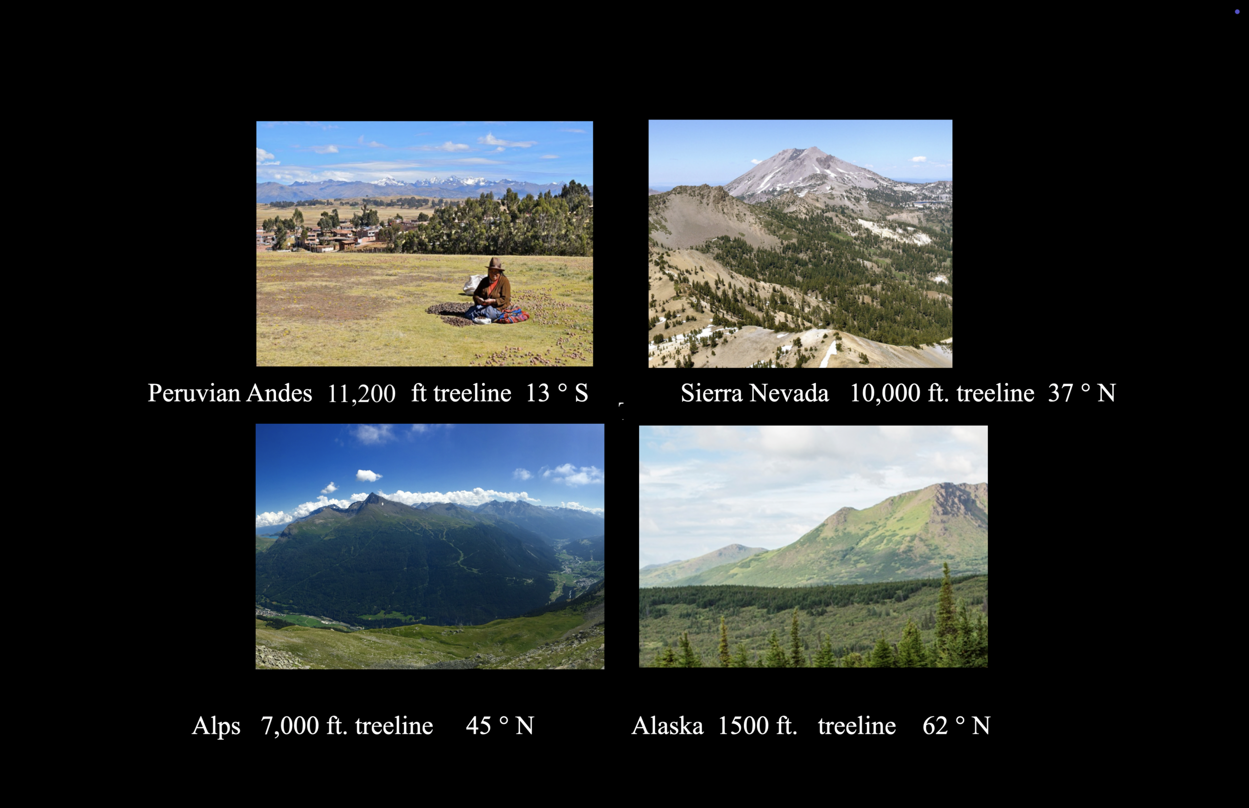
Various Latitude Tree lines (Photos P. Hunt, 1988-2024)
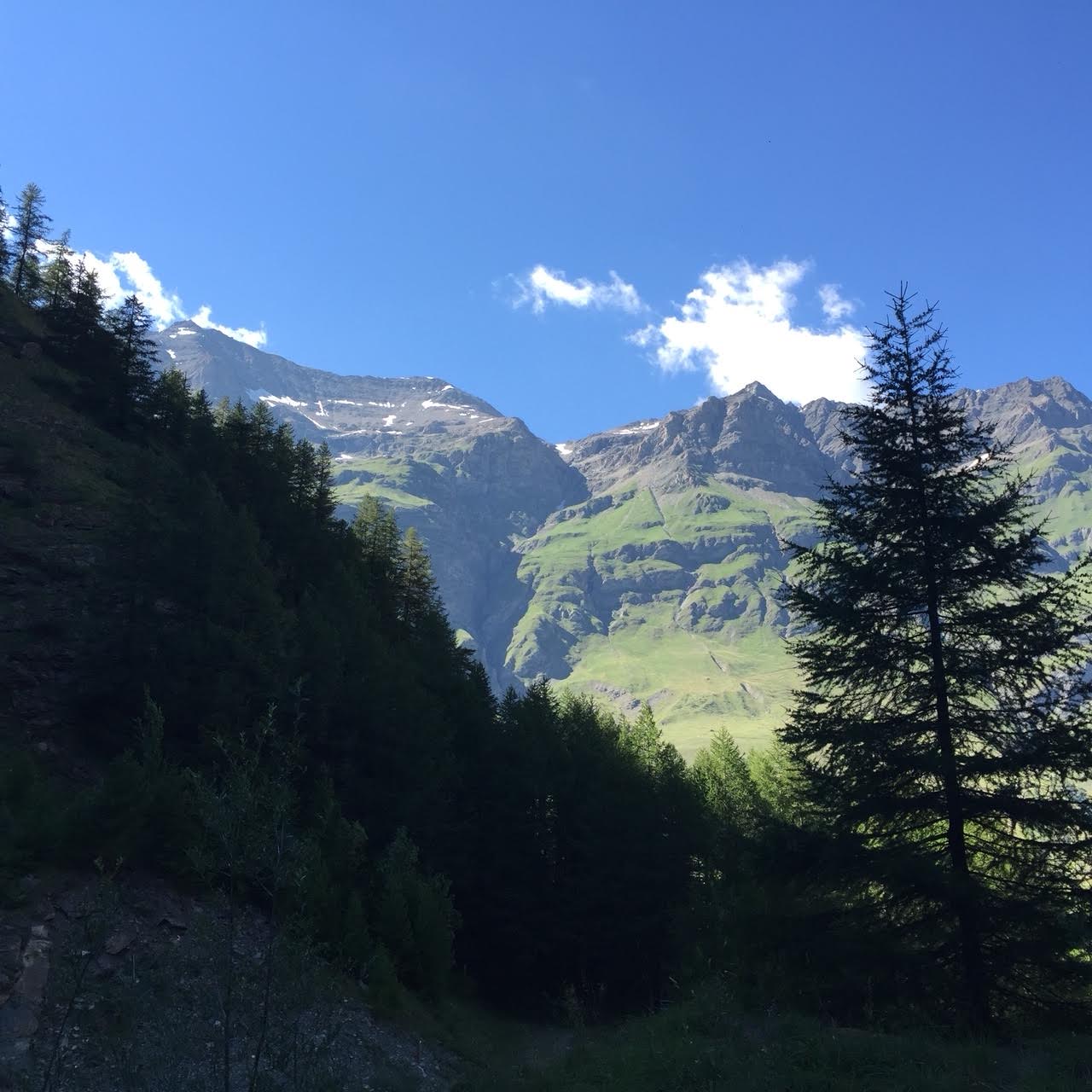
French Cottian Alps at 45°N with Larch (Laryx sp.) forest Tree Line at ~1800-2200 m (~6,000-7000 ft.) (Photo P. Hunt 2016)
Lichenometry Applications
An application to montane archaeology is also relevant. Although typically used more in glaciology, in studying datable lichenometry I find the same basic Rhizocarpon geographicum or related genus crustose lichens (found on silicate rock with yellow-green/green hues) with their datable radial growth surviving in very different latitudes but all sharing similar climatic zones and other variables. After chemical and UV fluorescence testing for species verification, one can survey along Celto-Roman roadbeds at ~2400-2500 m, (~8,000 to ~9000 ft.) altitude in in the Alps around 45° N. These archaeological contexts are usually at summit passes where the same silicate stone laid down by humans and buttressed against steep slopes have demonstrated large Rhizocarpon lichen thalli, with some even up to ~104.95 mm in diameter as this author has recorded and published. These latter examples are estimated at around 2500 BP but possibly even up to 3000 years old. This author commonly finds Rhizocarpon examples of ~45-50 mm thallus diameter on Roman Roads already dated by artifacts from late 2nd to early 3rd c. CE, e.g., Col de Clapier between France and Italy at ~2477-2600 m (~8,500-9,000 ft.) elevation, and 50-60 mm thalli diameters at the rock-cut Roman road (Flavian period ca. 70-90 CE) at Col du Grand-St-Bernard between Switzerland and Italy between ~2400-2480 m (~8,000-8,500 ft.) elevations. Since in both mentioned Roman road contexts (Clapier and Grand-St-Bernard) the Rhizocarpon lichens grow on known and well-dated silicate monuments, lichenometry can be an applicable relative dating verification tool.
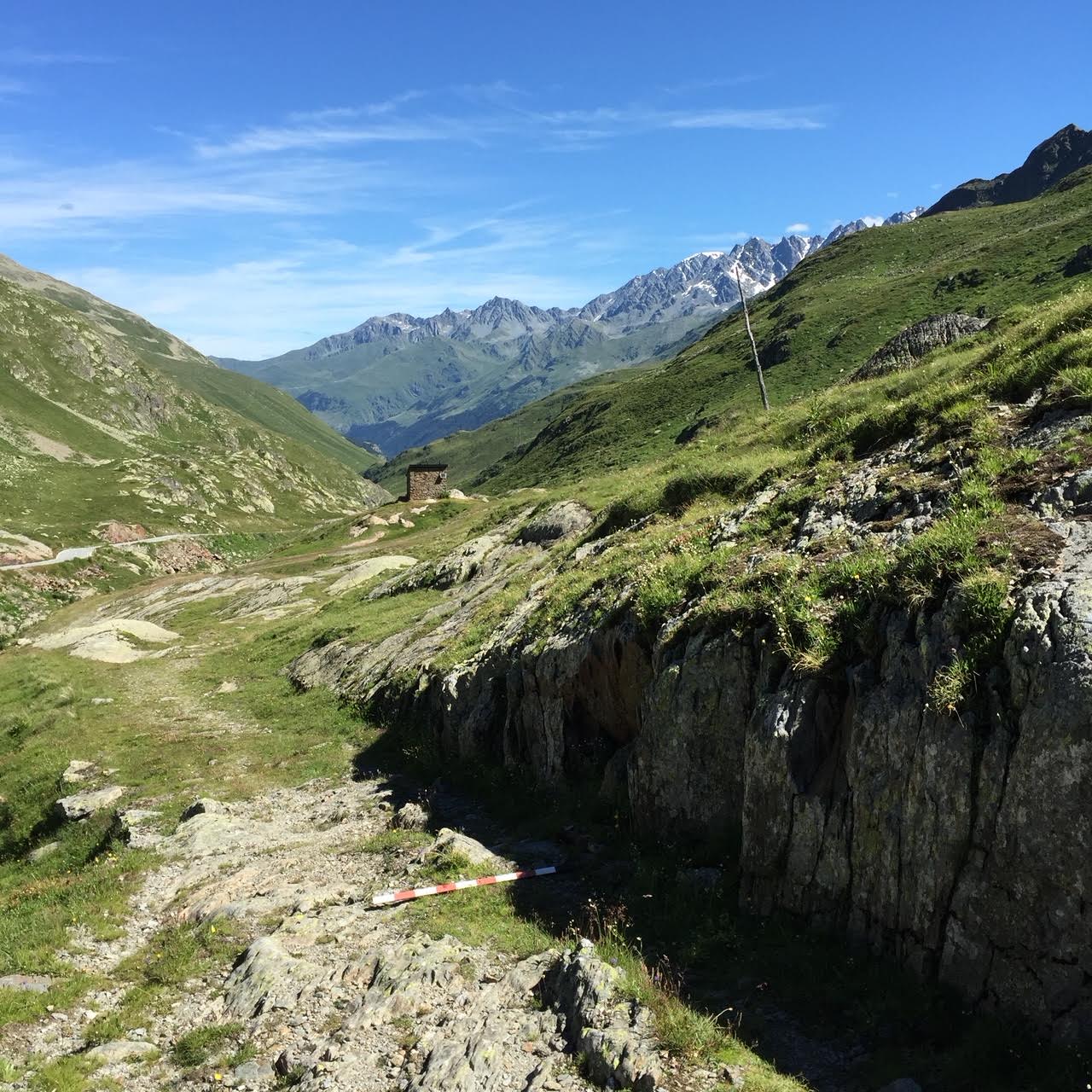
Roman rock cut Road (Via Alpis Poenina) at Grand-St-Benard Pass near 2400 m (~8000 ft.) elevation (Photo P. Hunt 2016)
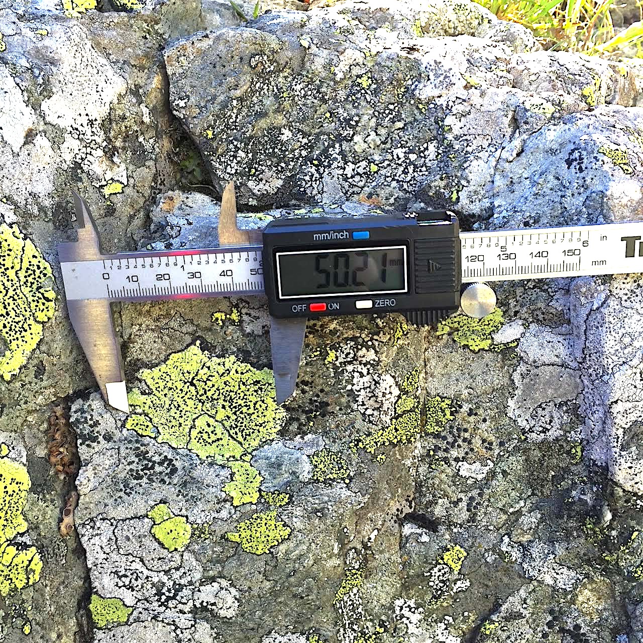
Rhizocarpon thallus 50.21 mm diameter at Roman Rock-cut Road (Via Alpis Poenina) Flavian late 1st c. CE) Grand-St-Gernard Pass ~2400 m (8000 ft.) elevation (Photo P. Hunt 2016)
This author also often finds in Norway’s 18th-19th c. cemeteries absolute dated gravestones on silicate stone with much smaller Rhizocarpon lichen thalli around ~15-20 mm in diameter around 62°N, with all other variables except latitude and age of lichen – and therefore size – (stone type, climate, sun-facing and dominant wind-facing direction, angle and solar azimuth, etc.) being the same, since it is a silicate rock lichen. In the tropical latitudes of the Andes, Rhizocarpon lichen is found only at very high altitude between ~3500-5000 m (~11,500 – 16,400 ft) elevations. With very long lifespans up to 10,000 thousand years in rare examples, Rhizocarpon geographicum’s estimated rate of growth is often measurable between averages of 0.1-0.8 mm annually depending on factors such as exact silicate rock variety as well as solar and UV exposure along with climate. For large lichen thalli >50 mm, the growth rate likely slows down to far less annual incremental increase, at times not even reaching 0.05-0.07 mm annually on average. The largest Rhizocarpon thalli appear to grow the slowest after around 2000 years possibly even slowing down to 0.01 mm annually in some contexts.[6] After the “ecesis interval” delay when lichens first establish on rock faces, thallus growth starts faster, but ultimately averages out much slower in an asymptotic curve as mentioned. So in the Alps, for example, this Rhizocarpon lichenometry is more applicable to measuring ancient contexts (e.g., Gallo-Roman) [7] with lichen thallus >45 mm rather than more recent. Others have also applied Rhizocarpon lichenometry in higher elevations of Himachal Pradesh (Himalayan) India, (e.g., Dharamshala) measuring the largest specimens on well-dated monuments averaging 2000 m in elevation, applied “where dating may exceed 1000 years”. [8] The general lichenometry logical tenet is the larger the radial thallus, the older it is and vice versa.[9] So it is best to look for the largest lichen thalli in a given context as these will in general be the oldest. It is also best to find independent single thalli rather than intersected with others. The variability of thallus growth, however, means lichenometry is less applicable across wide geographic contexts, but possibly more applicable within the same region if all variables are shared. There is valid criticism of attempting to apply lichenometry indiscriminately without factoring both its growth inconsistencies and the full variables that apply. But lichenometry can serve as a relative chronometer in archaeology, as this author has published elsewhere in archaeometric studies on lichen relative dating. [10]
Again applying Humboldt’s altitude-latitude correlate, one can also use Xanthoria elegans genus lichens (orange-red) at slightly lower altitudes around 2200 m (~7000 ft.) in the Alps along medieval roads. It is also observable in much younger monuments as well near sea level in coastal Norway at comparable Arctic latitudes (61-63 °N) for relative dating of more recent historical monuments. This understanding of Xanthoria lichen is true in the Alps especially for medieval contexts like walls, or also true for much smaller lichen thalli on late 18th c. to early 19th c. Norwegian cemetery gravestones. Xanthoria lichen has a measurable relative rate of growth of ~0.5-0.7 mm annually on silicate rock but faster growth on preferred carbonate rock, but its growth rate also slows down to possibly ~0.2 mm or less annually after hundreds of years. I have even surveyed large Xanthoria lichen growth in Peru on ~500 year old Inca igneous (andesite) stonemasonry at both Ollantaytambo at 2800 m (~9200 ft.) at 13° S in the Yucay Valley and also on granite Inca walls at Machu Picchu at ~2400 m (~8000 ft.), the latter mostly tropical, with radial Xanthoria thalli up to ~114 mm (~4.5 in) in diameter. Even though Machu Picchu at ~13°S latitude is in a tropical climate zone at an altitude of ~2400 m (~8000 ft) , more or less the same lichens grow in diverse latitudes because there habitats are usually more climate-driven than anything else.
In conclusion, applying Humboldt’s altitude-latitude correlation to vegetation zone habitats (vital factors for historical agriculture event since prehistory), and also when applying it to lichenometry – whether in the Andes, the Alps, Scandinavia or elsewhere – it can be a useful research tool, as lichenometry has potential especially relative dating in archaeology.
Notes:
[1] Andrea Wulf, The Invention of Nature: Alexander von Humboldt’s New World. Vintage, 2015, 14-5.
[2] Voyage de Humboldt et Bonpland, Atlas Pittoresque, vol. 1. Paris: F. Schoell, 1810.
[3] Julian Smith. “Humboldt’s New World.” The Nature Conservancy 2013 (https://www.nature.org/en-us/magazine/magazine-articles/humboldts-new-world-1/).
[4] A. v. Humboldt, Political Essay on the Kingdom of New Spain, London, 1811, vol. 2, p. 46.
[5] ibid.
[6] R.A. Armstrong. “Growth Curve of the Lichen Rhizocarpon geographical.” The New Phytologist 94.4 (1983) 619-22; R.A. Armstrong, T. Bradwell. “The Use of Lichen Growth Rings in Lichenometry: Some Preliminary Findings.” Geografiska Annaler 92.1 (2010) 141-7; ”J.A. Matthews, H.E. Trenbirth. “Growth Rate of a Very Large Crustose Lichen (Rhizocarpon subgenus) and its Implications for Lichenometry.” Geografiska Annaler 93.1 (2011) 27-39; S. Roof, A. Werner.”Indirect Growth Curves Remain the Best Choice for Lichenometry: Evidence from Directly-Measured Growth Rates from Svalbard.” Arctic, Antarctic and Alpine Research 43.4 (2011) 621-31; R.A. Armstrong. “Lichenometric Dating (Lichenometry) and the Biology of the Lichen Genus ‘Rhizocarpon’: Challenges and Future Directions.” Geografiska Annaler 98.3 (2016) 183-206.
[7] Patrick Hunt. “Summus Poeninus on the Grand St. Bernard Pass.” Journal of Roman Archaeology XI (1998) 265-74.
[8] R.K. Chaujar. “Lichenometry of yellow Rhizocarpon geogrpahicum as database for the recent geological activities n Himachal Pradesh.” Current Science 90.11 (2006) 1552-4.
[9] Matthews, 2016, 183 & ff.
[10] P. Hunt. “Lichenometry Dating in the Alps with Hannibal Route Implications”, Atti Accademia Roveretana degli Agiati 9, Rovereto, Italy (2015) 67-84.