By Jess Taylor –

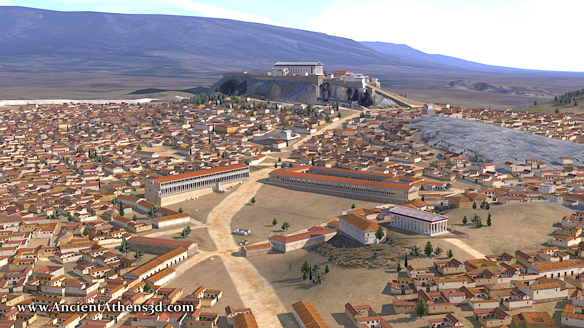
Mapping the Greek Polis (Poleis in plural)
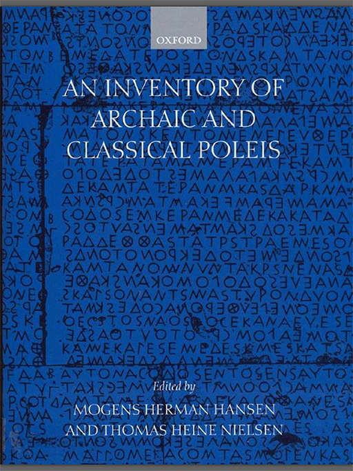
Where were the ancient Greek cities located? What was their sphere of influence? And what did it mean to be a polis? A pioneering body of work analyzed 1,035 ancient Greek settlements from the archaic and classical periods (c. 650-325 BC). Ten years in the making, the results were produced by the Copenhagen Polis Center in a document titled An Inventory of Archaic and Classical Poleis by M.H. Hansen and T. Nielsen. The “Inventory†was first published in 2005.
The novel intent of the Copenhagen team of ancient historians and archeologists was to scour the written and archeological record to attempt to quantify, discarding any a priori assumptions, what it meant to be a Greek polis. The region of study was broad, covering poleis located across the Mediterranean and Asia Minor.
For Hansen and Nielsen et al., a polis “is an ancient concept and reflects the ancient Greeks’ understanding of their own political and social orderâ€. They avoided the commonly associated term “city-state†in their contemplation of a polis because it a modern term and implies a level of self-sufficiency when it might not exist.
The result is a marvelously detailed catalog and description of poleis organized in a uniform construction of physical and historical parameters such as Region, Location, Size (spatial influence), Existence, Colonies, Coinage, Fame, Policity, Democratic, Hellenicity, Walls, City Grid Pattern, Delian and / or Koinon membership, Panhellenic Game victors, and Proxenoi.
Why the app?
Upon first discovery of the Inventory one is easily excited to find such a treasure trove of information about these ancient Greek communities. Quickly, however, one might realize there is a glaring omission. There are no maps to guide the reader on where each polis is located or its geographical relationship with other poleis.
Reading further one learns that, rather than create and publish their own maps, the authors referenced the Barrington Atlas Of The Greek And Roman World, edited by Richard Talbert. And this is quite understandable; to say the Barrington Atlas is a phenomenal and serious reference is an understatement. Yet, it is a paper atlas and the Inventory directs you to the page in the atlas on which you will find the location of the polis if you look for it (you can find a digital version of the Barrington Atlas on the Apple app store here, but the problem remains).
Therefore, the purpose of the Polis-Inventory app is to fill the gap between the Inventory and the Barrington Atlas. To provide the missing visual whereby you can seamlessly explore the geographic extent of the poleis superimposed on modern satellite imagery.
As a result, the Polis-Inventory map-based app is interactive and informative, allowing for visualization, searching, and filtering of the poleis based on its named set of physical and historical parameters.
And, being published on the Apple platform, free of charge, available on the iPhone, iPad and MacOS, the app can be easily used as an in-situ field / travel reference and in a desktop-oriented research environment.
The Polis-Inventor app is designed to be a companion to the Inventory with the aim of augmenting and enhancing one’s consumption of the Inventory.
The Digital Data
The data for the 1035 poleis mapped in the Polis Inventory app is derived directly from the website polis.stanford.edu, managed by the Stanford University Classics Department.
After the Inventory was published, other classical scholars, notably Josiah Ober and his colleagues and students at Stanford, began to develop digital versions of the printed material in spreadsheets. The result of this effort is presented on their website and their data is made freely available to the public for academic use and general interest and study.
Further detail about this data, and more detailed accreditations than found in this article or in the Polis Inventory app itself, may be found on the Stanford website.
Keeping with this spirit of data accessibility, users of the Polis Inventory app may access a copy of the data from the “About†page in a GeoJSON format.
App Functionality
The Polis-Inventory app maps the 1035 poleis superimposed upon modern digital satellite images. A user may explore the map spatially by panning and zooming. Selecting a specific polis presents a summary of the named data about each polis. Using the search pane, one may directly navigate to a particular polis. A set of data filters are also available to narrow the dataset, for example to see the set of poleis located above a given elevation or this with evidence of fortification, and so forth.
The app is available on the iPhone, iPad and Mac. The screen shots that follow are taken from renditions of the iPhone and iPad.
Explore
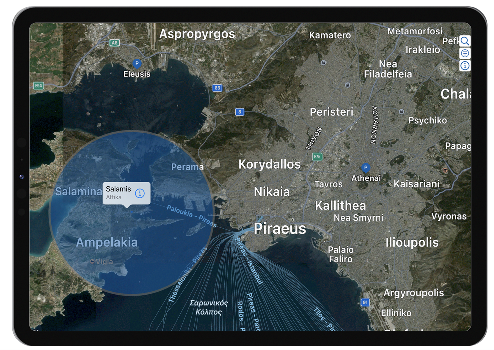
Zoom and pan to interactively locate poleis on the map as indicated by the blue P(olis) markers. Each marker displays the name of the polis underneath.
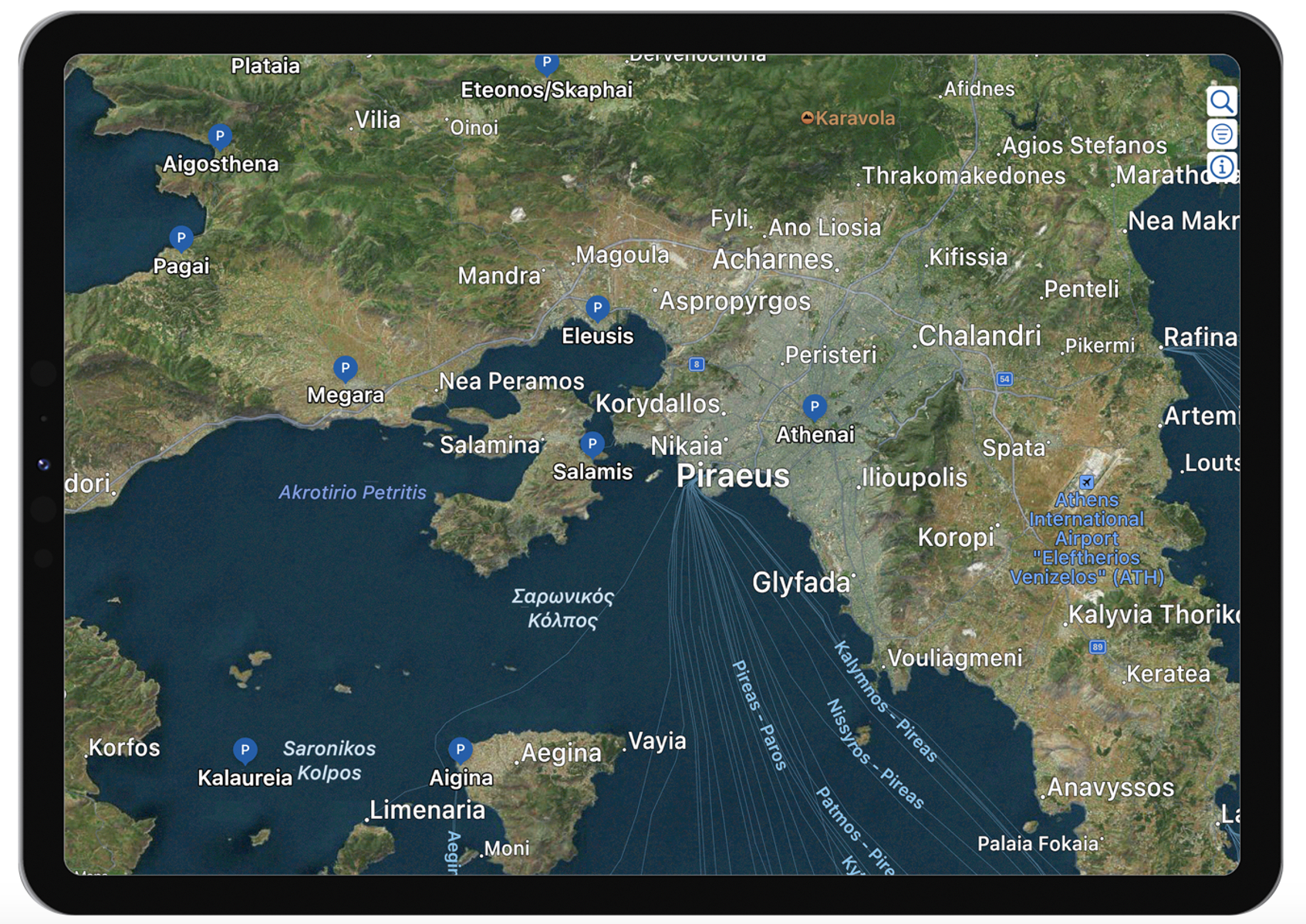
Tap on a marker to produce the caption view. In addition to the city name, the caption shows the region’s name, and an overlay also appears (blue circle) that depicts the spatial of Influence (size) of the city as reported by the Inventory. In the cases where the city Influence is unknown, the blue circle turns white. For the cities with very large or unbounded Influence the gray enclosing band is removed.
Polis Detail Pane
Tapping the caption will launch the city Detail Pane that displays the named set of physical and historical parameters for that city, as described in the Inventory.

Search Pane
To look up a city by name you can use the Search Pane. Type in a name and tap the cell where it appears, and the map will “fly†over to it.
Filter Pane
For deeper exploration of the dataset, filters are provided for each parameter listed in the Detail Pane. Use the filters to narrow the dataset to an area of interest. Tap the reset button to remove all filters.

Info Pane
Key of Terms
A Key of terms (below left) and their associated filter ranges for all parameters can be found on the first tab of the Info Pane.

About
The About tab (above right) includes important references and accreditations regarding the data that include a link to the Sanford University site polis.stanford.edu. You will also find a button that will allow you to copy the data to your clipboard in a GeoJSON format.
The Lost Poleis
As previously mentioned, the Inventory catalogs 1035 poleis. What may come as a surprise is many of these ancient cities are not definitively located or are not located at all. The Inventory reports that 166 poleis are “unlocated” (~15% of the catalog). We know something of these poleis from historical writing and record keeping, but we have no definitive archeological evidence for them. Improvements in locations are constantly being made and this current dataset lists 129 of 1035 poleis as “unlocatedâ€.
Given the inspiration of the Polis Inventory App is to plot all the poleis geographically on an explorable map, what are we to do with these “loction” orphans?
One logical solution is to group them by region and pick a group location that is near to their assigned region, typically, but not always, located over water to avoid any overlap with poleis that have verified locations.
An example is given below (lower left), when you find a gray bounding circle (as opposed to blue or white circles that relates to a polis’ spatial influence) you will know that group of poleis are plotted together that have unknown locations but are situated nearby their associated region.
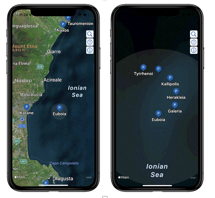
Zooming closer (upper right), you will observe the “lost†poleis are plotted in the shape a Fermat spiral so they do not overlap each other and to visually enhance the fact that their locations are contrived.
Get The App
The Polis-Inventory app is available free of charge on the Apple app store. It can be found here or alternatively by searching the store for “polis inventoryâ€. The iPhone, iPad and Mac platforms are supported.
A version of the app for the Android platform is not currently available.
References
- An Inventory of Archaic and Classical Poleis by Hansen & Nielsen (2005 ISBN-13: 978-0198140993) Amazon
- Barrington Atlas of the Greek and Roman World (2000 ISBN-13: 978-0691031699) Amazon Apple App Store
- Polis by Stanford University https://polis.stanford.edu
- Josiah Ober @ Stanford University https://classics.stanford.edu/people/josiah-ober
- Polis Inventory App on the Apple App Store https://apps.apple.com/us/app/polis-inventory/id1527341314